


Map of the Southern Region


I created a map of the Southern Region because there wasn't one, and I knew my friends would enjoy it. It also won the Baronial A&S Championship in the Barony of Settmour Swamp, and a populace choice competition at Southern Region War Camp. Below is the write-up, using the St. Eligius rubric.
What did you make or do?
This piece is a 21”x30.5” map of the Southern Region of the East Kingdom. It was pieced together using outdated territory maps on the East Kingdom wiki, maps on Baronial and Shire websites, and then inputting remaining zip codes into Google maps. The map was styled after several 16th century maps, with a couple elements from 15th century maps. The map was illuminated with a beautiful period paint set that I received as a prize for winning St. Eligius in 2025. It is not intended to be a replica of any particular map, but pulls from elements of many different maps just as many of those maps were initially created.
What is the connection between your entry and a medieval item or practice?
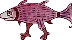
I studied many maps for this project. I used painted borders like from the Domingos Teixeira (1573). The sea creatures, flags, fleur de lis compass, and some of the border art are painted based on the “Cosmographie universelle, selon les navigateurs tant anciens que modernes” by Guillaume Le Testu (1555). The heraldry border and ocean are based on Georg Erlinger’s Map of Central Europe (1530).
There are two cheeky Latin phrases used on the map. The first is based on the 1508 Hunt Lennox Globe’s “hic sunt dracones” (here be dragons). This globe is the first known instance of that commonly-quoted phrase. On my map, I similarly wrote “hic sunt daemones” (here be demons/devils), placed over the NJ Pine Barrens in reference to the mythical Jersey Devil (and the demons on the Shire of Barren Sands’ heraldry). The second is based on “mille viae ducunt homines per saecula Romam” which translates to “a thousand roads lead men forever to Rome” or more colloquially, the famous saying “all roads lead to Rome.” Here instead, I wrote “mille viae ducunt homines per saecula Pennsic” in the general area of I-76, one of the roads that people of the Southern Region often take to Pennsic.
How would your entry have been made in period?
In the 15th and 16th century, cartographers would use information and charts from expeditioners and sailors to create maps. There are extensive records on how angles and celestial bodies were used to determine distance, which helped create maps. But oftentimes, existing maps would be traded and copied. One famous example is Marco Polo, who brought back many maps to Venice from his trip to China. Fra Mauro’s Mappa Mundi, a famous hand-drawn 15th century Venetian map, and the most accurate map of its time, likely relied on parts of these. Prior to the 15th century, maps were largely decorative or served as propaganda more than as practical tools. However, starting in the 15th century, we see maps such as the Mappa Mundi that focused on accuracy to the best of their means.
In the 15th and 16th centuries, block printing was largely used for maps. By the end of the 16th century, copperplate printing was very popular for reproducibility of maps. This method was limited in the number of colors that could be used, so paint was added afterwards, if at all. However, some exceptional works of art were still entirely hand-painted, such as Fra Mauro’s Mappa Mundi (15th century) and Urbano Monte’s Map of the World (16th century).
How was yours made?
I attempted to emulate the work of a 16th century cartographer making a hand-drawn map from a collection of other maps.
Summarized Steps:
Researched the materials used for maps in the 16th century
Obtain comically large paper
Create an outline for the map and designs
Print out a map of zip codes in New Jersey, PA, NY’s southern region in pieces (due to printer paper limitations); tape the pieces of paper together to reform the map
Trace map onto comically large paper, leaving large margins for heraldry, borders
Sketch out the territories’ heraldry
Sketch fun little sea monsters, ship, mountains, trees for forests, flags for other kingdoms, etc. from various exemplars of the 16th century
Wrote calligraphy on the borders and for heraldry with carbon ink
Using watered down paints, outlined the kingdoms in their respective colors (red for Aethelmarc, blue for Atlantia, purple for East)
Added territory names, Latin map notes
Sketched out flags, scrolls, and all other remaining designs I didn’t want to paint over
Painted in trees, mountains, water features and the ocean with the period paints
Painted the border, lines, figures and beasts in period paints
Created the hatching effect around the heraldry with lamp black
What are some similarities and differences in materials, process, tools, approach?
Similar to other maps of the 15th and 16th century, the map of the Southern Region copies and has elements of a large number of maps, both period and modern. The art and design of this project is based on a large collection of mostly 16th century maps, whereas the actual borders of the territories are based on the modern resources and maps that I had available. Though many period maps were printed by copperplate or wooden block printing, this map of the Southern Region is focused especially on imitating hand-drawn and hand-painted maps. Cartography techniques used to create new and refine maps using new geographical data, such as angles and celestial positions, were out of scope for this project.
The paints used for this map are period paints, which I received as a prize for winning St. Eligius in 2025. I also used titanium white gouache (a safe alternative to the lead white often in use during the period). For black, I used carbon black ink, and lampblack single-pigment watercolor. Though the binder in these black colors are different from a period paint, the pigments are similar or the same as what would have been used in the 16th century.
What inspired you?
The period paint set I received from St. Eligius gave me a big reason to make a scribal art project for myself. I also think of the Southern Region as my “sports team” since I come from a household of heavy fighters, and I realized that there were no existing, up-to-date maps of the Baronies and Shires that we have come to love.
What was your favorite part of preparing your entry?
Using the period paint set for the first time was so satisfying. They paint similarly to gouache, but the pigments truly felt special. I also enjoyed the excitement of others in the Southern Region for this project - my friends helped me photograph the map so that prints could be made, and these have been very popular.
What would you do differently next time?
I learned a lot in this project, but the main thing I would do differently are the straight lines. I learned to use a ruling pen for the first time for this project’s very long straight lines, and it worked well. But one thing I did not account for is how the ink bleeds into gouache that is already on the page. This meant that the lines can’t be drawn over or beside existing paint. During my usual scribal work, I save lining my work for last. However in the future if I need long straight lines like this, I will need to do it first.
What references or sources would you recommend to someone interested in your work?
In addition to the references listed below, I would suggest looking into specific tools for creating maps such as a ruling pen and a lining brush (available on John Neal Books). You can also find more maps from various periods at sites such as https://www.oldmapsonline.org.
How did you find your sources of information?
Most sources were found by searching online, or by reviewing the sources of Wikipedia pages of known maps. I heavily prioritized sources that were posted in reputable journals or by museums. No AI was used in the creation of this work or its documentation.
Did you find a connection to a medieval artisan or owner while working on your entry?
Though my map was largely focused on 16th century references, I loved reading about Fra Mauro and his Mappa Mundi from the 15th century. He was a Venetian monk who lived in Venice his whole life, yet somehow made the most accurate map of its time using the works of others. In the SCA, a similar kind of resourcefulness is what allows us to do our work. We may not be able to travel to Rome and perform an archaeological dig ourselves, but we can learn from those who have.
Any last thoughts or amusing stories about your work?
Since the previous maps were created, there have been many changes to the Southern Region. Some were simple name changes, but some shires and cantons have gone defunct and required complete re-mapping by zip code. There are no current zip code lists available to the general populace (me), and the only list someone was kind enough to provide me did not include Cantons, which I wanted for this zoomed-in version of the Southern Region. There was a lot of manual labor preparing for this project, inputting zip codes into the East Kingdom branches webpage and then Google maps to finalize the map’s borders. Though period maps are not very accurate and are in many cases wildly exaggerated, I wanted this map to be fairly usable as a reference for the SCA.
Because of this adventure, I like to joke that I have been personally attacked by zip codes.
References
Georg Erlinger Map of Central Europe (British library would have been the source)
Border of the map, general design of map and heraldry,
Page 36v, 37v (fish), 57v (flag), 58v (border)
https://gallica.bnf.fr/ark:/12148/btv1b8447838j/f80.item.zoom
Fleur de lis compass
https://www.museum.unc.edu/exhibits/show/comcarcre/artmap
1585 map of the East Coast up to NC
Watercolor and graphite
History of painting on maps and pigment history
As map printing became more and more accessible, color began to play a more active role. In the 16th century the colors added to maps were thick and opaque, made from natural dyes and pigments.
https://mostre.museogalileo.it/framauro/en/interactive-exploration/geographic-space/cartouches.html
15th century monk
https://artsandculture.google.com/story/fra-mauro-s-mappa-mundi/8QXhzVkYn-sMLA?hl=en (more information)
https://ehne.fr/en/encyclopedia/themes/wars-and-memories/war-fronts/figuring-war-maps-in-europe
Info about maps in a historical context for warfare
https://gallica.bnf.fr/ark:/12148/btv1b550024840/f70.item
A 16th century document showing methods for calculating distance with angles
https://blogs.loc.gov/maps/2024/03/fabricating-the-world-copperplate-printing/
Copperplate printing for mapmaking
Urbano Monte’s map of the world
https://gallica.bnf.fr/ark:/12148/btv1b525032167/f1.item.zoom
1573 hand-painted map, paint around borders

